




In the wake of climate-related disasters and the escalating pressures of urban congestion, municipal governments are increasingly turning to "smart" infrastructure to bridge the gap between legacy systems and modern requirements. Nowhere is this transition more critical than in Harris County, Texas, where a partnership with traffic technology firm Miovision is transforming the way emergency vehicles navigate the chaotic intersection of public safety and traffic management.
By integrating advanced vehicle preemption systems and AI-powered data analytics, Harris County is setting a precedent for how American cities can leverage digital infrastructure to enhance public safety, reduce emergency response times, and optimize the flow of everyday traffic.
The Genesis: Hurricane Harvey and the Catalyst for Change
The urgency for an upgraded traffic management system in Harris County was not born out of a desire for convenience, but from a necessity defined by catastrophe. In August 2017, Hurricane Harvey delivered a historic deluge to southeastern Texas. The storm did more than just flood neighborhoods; it crippled the region’s critical infrastructure, including its existing traffic control systems.
Reports indicate that approximately 25% of Harris County’s intersections—many of which were equipped with emergency vehicle priority (EVP) systems dating back to 2007—were rendered dysfunctional or unreliable by the flooding. The failure of these legacy systems during a period of peak emergency demand highlighted a glaring vulnerability: when the pressure is highest, static, aging technology is prone to collapse.
In the aftermath, officials from seven Emergency Service Districts (ESDs) recognized that they could no longer rely on the fragmented, hardware-heavy infrastructure of the past. They sought a solution that was not only resilient against environmental volatility but also capable of seamless integration with existing emergency fleets. This led to a strategic contract with Miovision, a leader in intelligent traffic management, to implement a sophisticated vehicle preemption system designed to modernize the county’s response capabilities.
The Technology: How Smart Intersections Function
At the core of the Miovision implementation is the transition from "dumb" traffic signals to intelligent, interconnected nodes. Traditionally, most signaled intersections in the United States operate via a control cabinet housing pre-programmed timing plans. While some advanced intersections utilize pavement-embedded vehicle detectors to adjust timing based on traffic volume, these systems are often reactive rather than proactive.
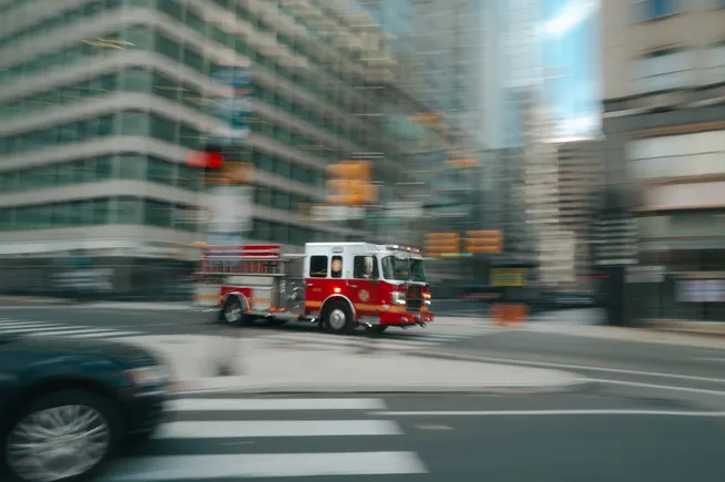
The Miovision system upgrades these intersections into dynamic assets. By utilizing technology already embedded within the county’s emergency vehicles, the system creates a digital handshake between the approaching ambulance or fire truck and the traffic signal controller.
Key Components of the Upgrade:
- Vehicle Preemption: As an emergency vehicle approaches an intersection, the system proactively shifts the signal to green, clearing a path through congested traffic and reducing the likelihood of collisions.
- Centralized Management: Unlike the previous, siloed systems, the new platform allows for remote management. This eliminates the need for manual, site-specific adjustments, allowing a small team of engineers to oversee vast stretches of the county’s traffic grid.
- Data Integration: By capturing real-time traffic flow data, the system does more than just prioritize emergency vehicles; it learns the rhythms of the city, allowing for optimized signal timing that benefits the general public during off-peak hours.
Official Perspectives: Efficiency in Public Safety
For the agencies tasked with public safety, the value of this technology is measured in seconds—seconds that frequently determine life or death outcomes.
Mike Pate, Project Manager for Harris County ESD Number 16, emphasizes that the primary benefit is the reduction of administrative and operational strain. "The fact that we don’t need resources committed to supporting the day-to-day operation of the system is a godsend," Pate stated. "In public safety, you never have enough money and you never have enough people. By automating the preemption process, we allow our personnel to focus on the mission of saving lives rather than troubleshooting technical infrastructure."
This sentiment is echoed by broader industry experts who view Harris County as a bellwether for the "digitization of the intersection." Kurtis McBride, CEO of Miovision, believes the shift is inevitable. "What’s coming is ultimately going to be a full digitization of the intersection," McBride told Smart Cities Dive. He envisions a future where connected and autonomous vehicles provide a rich layer of situational awareness that goes far beyond simple traffic light status, potentially alerting emergency services to accidents or road hazards before they even arrive at the scene.
The Broader Impact: Data-Driven Urban Planning
While the immediate goal of the Harris County project is emergency response, the implications for urban planning are profound. In July, Miovision launched an AI-powered platform designed to aggregate diverse traffic studies into a single, cohesive dashboard. This allows traffic engineers to query historical data, generate instant reports, and identify the root causes of congestion in their communities.
Quantifying the Urban Problem
"A big part of what we do today is help cities to quantify their problems," McBride noted. In the past, traffic studies were expensive, time-consuming, and often outdated by the time they reached the desks of city planners. By digitizing this process, Harris County can now identify "hot spots" for traffic incidents, analyze the impact of new construction projects, and make data-backed decisions regarding road expansions or signal modifications.
The efficacy of this technology is backed by significant metrics. Miovision currently connects over 100,000 intersections across North America, and their data suggests a 10% to 30% improvement in stop delays in areas where their technology is active. For the average commuter, this translates to less time idling at red lights and lower fuel consumption; for the city, it means a more efficient transportation grid.
Chronology of the Transition
- 2007: Initial installation of legacy emergency vehicle priority (EVP) systems in Harris County.
- August 2017: Hurricane Harvey causes widespread flooding and failure of roughly 25% of the county’s signaled intersections.
- Post-2017: Harris County ESDs initiate the search for a more resilient, cloud-integrated traffic solution.
- 2023: Full-scale rollout of the Miovision vehicle preemption system across the seven ESDs, utilizing existing emergency fleet equipment.
- July 2023: Miovision unveils its AI-powered traffic studies platform, enabling advanced data analytics for city engineers.
- Present: Ongoing optimization of the system to improve response times and general traffic throughput across Harris County.
Implications: The Future of the "Smart City"
The partnership between Harris County and Miovision serves as a microcosm for the larger digital transformation of American infrastructure. As cities grow denser and the impacts of extreme weather become more frequent, the traditional model of "set it and forget it" traffic management is no longer viable.
Economic and Environmental Benefits
Beyond safety, the environmental impact of optimized traffic flow is non-trivial. Vehicles idling at intersections are a major source of urban emissions. A 10% to 30% reduction in stop delays, as reported by Miovision, results in a quantifiable decrease in carbon output—a key factor for municipalities striving to meet sustainability goals.
The Autonomous Vehicle Frontier
As we look toward the future, the infrastructure being laid down today in Harris County will serve as the foundation for autonomous vehicle (AV) integration. An autonomous vehicle is only as effective as the environment it navigates; by providing AVs with digital infrastructure that communicates real-time signal states and traffic conditions, cities can accelerate the safe adoption of self-driving technology.
Conclusion: A Model for Resilient Infrastructure
Harris County’s journey from the devastation of Hurricane Harvey to the adoption of a cutting-edge, AI-enabled traffic network illustrates the power of proactive urban policy. By prioritizing digital resilience, the county has not only secured a faster, safer environment for its emergency responders but has also positioned itself as a leader in the data-driven management of public spaces.
The transition to smart intersections is no longer a futuristic concept—it is a functional reality. As other municipalities look to follow in the footsteps of Harris County, the lessons learned here will be vital: focus on interoperability, prioritize the automation of maintenance, and above all, use data to solve the human problems of public safety and urban congestion. In the digital age, the most powerful tool a city possesses is not concrete and asphalt, but the intelligent network that connects them.
